

Overview
A multimodal transportation plan is in the works for the Pagosa Springs East End area that will assess pedestrian sidewalk and trail connectivity, river and park access, public parking, functionality of roadways and traffic flow in the area, transit opportunities, urban design updates, and more. The plan aims to create a stronger connection between the East End and other areas of town, while providing a better functioning multimodal environment that supports access to businesses and recreational opportunities for residents and visitors alike.
What is a multimodal plan? Multimodal refers to a variety of different transportation types – vehicles, pedestrians, and cyclists – and the availability of infrastructure to support these different groups. The East End Multimodal Plan will evaluate how traffic currently moves through the area and potential changes that can help to alleviate some of the current challenges. The plan will evaluate parking availability and how people access the various parking areas within the East End. Finally, the plan will examine walking and biking conditions and will propose improvements to make walking and biking safer for people going to businesses, the Farmers Market, and recreational opportunities. The plan document will define a vision that will specify actions, priorities, funding opportunities, and next steps for the Town.
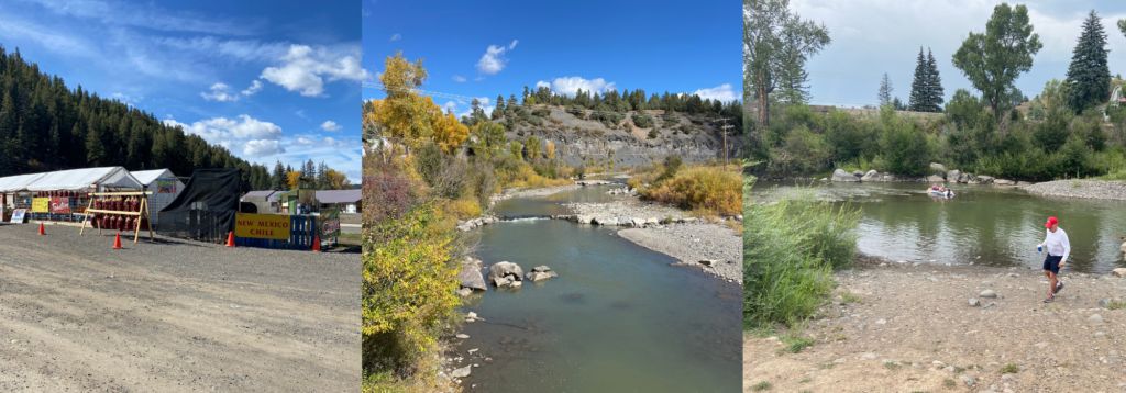
Where is the East End Study Area? The East End Study Area extends roughly between First Street to just east of the Highway 160/84 interchange.

Community Input
We have valued your input, involvement, and critical feedback through each step of the project! In total, we hosted four public input meetings: three in person and one virtual, and have also allowed the public to provide comments throughout the project on the project website. We also sought feedback through a virtual survey in November. Business and property owners in the East End were provided a separate survey to understand key transportation and connectivity issues moving forward. The ideas and comments provided through the meetings and surveys have been incorporated into the final plan.
Schedule of Community Input Opportunities
Public Meeting #1: Existing Conditions, October 6th, 2021
Public Meeting #2: Visioning & Opportunities, December, 2021 (virtual / online)
Public Meeting #3: East End Scenarios (April 27, 2022)
Public Meeting #4: Recommendations & Priorities (September 21, 2022)
Share Your Feedback
View and share your comments on the project boards from the latest public meeting, held in Pagosa Springs on September 21st. Click the images below to see them full screen, or download a pdf of all of the following slides here. After reviewing the boards, we invite you to vote for your top priority projects (more details below).
Phase 3 Public Input Summary

"*" indicates required fields
Preferred Concept Overview

"*" indicates required fields
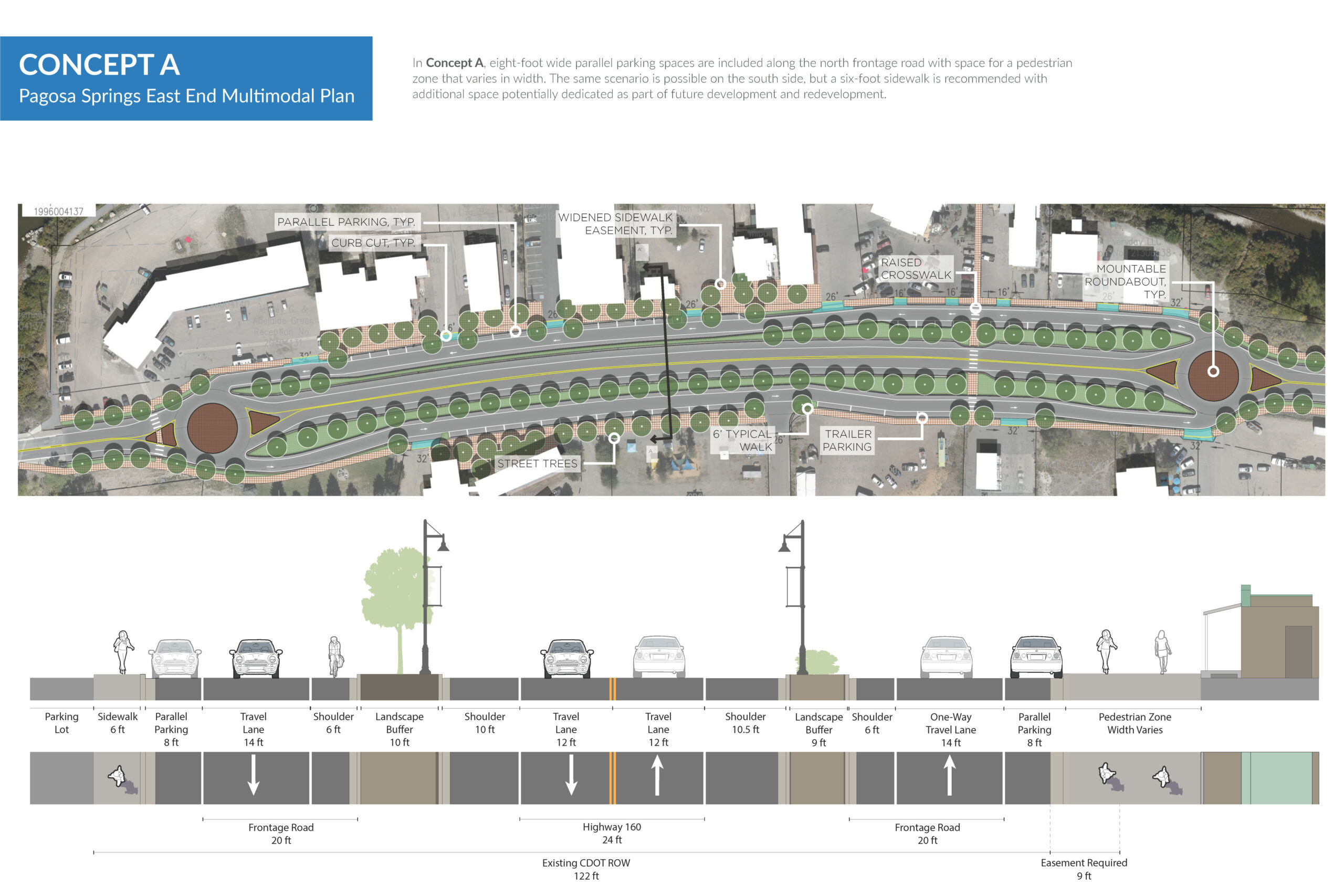
Concept A
"*" indicates required fields
Concept B

"*" indicates required fields
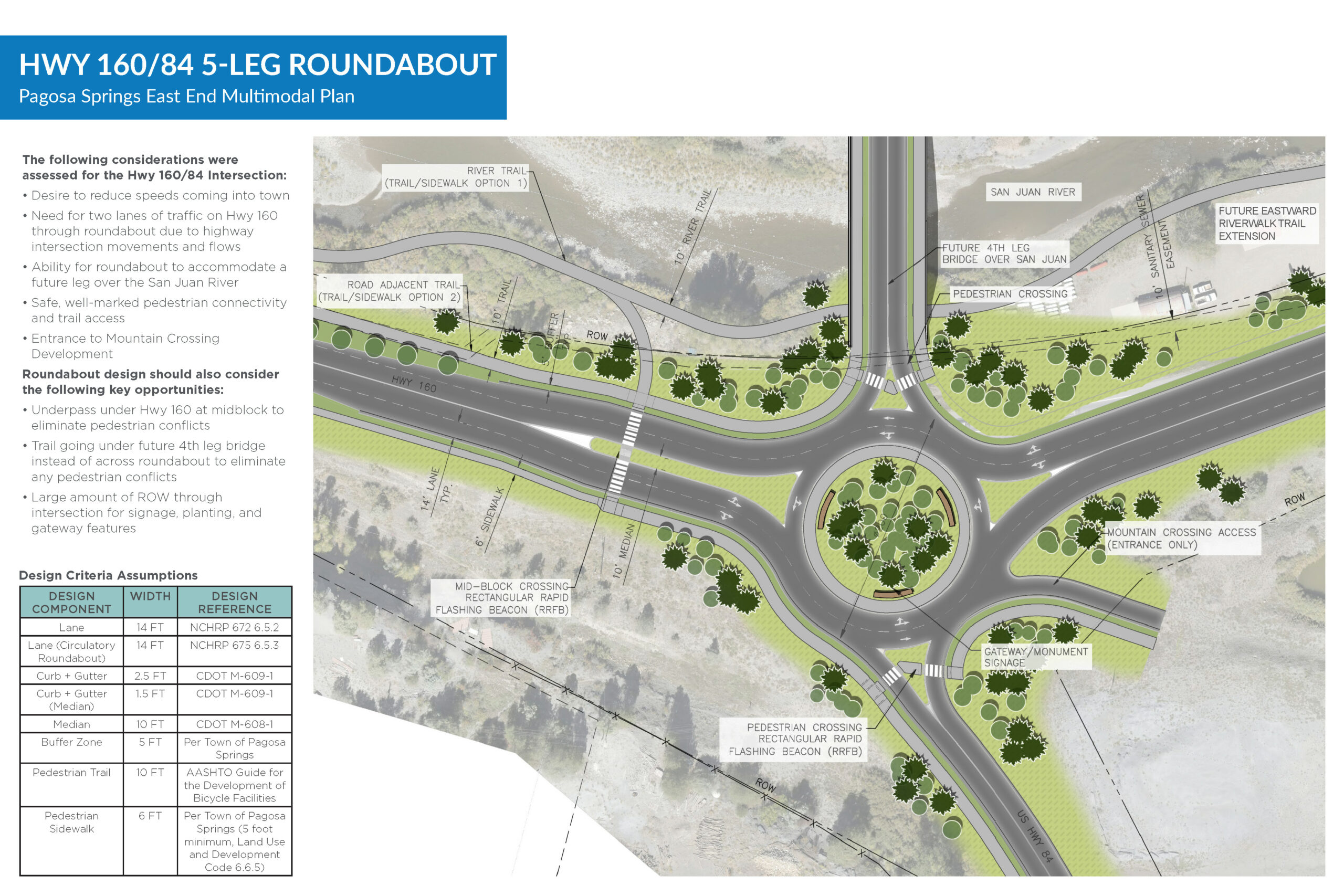
Hwy 160/84 5-Leg Roundabout
"*" indicates required fields
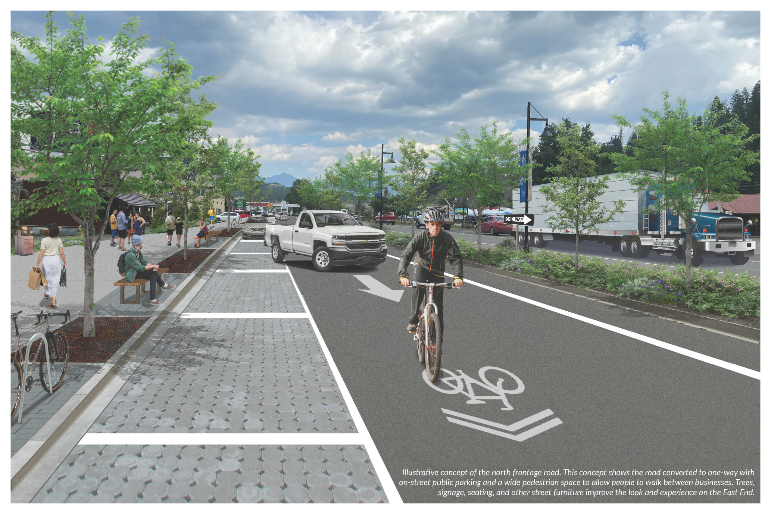
Illustrative Concept
"*" indicates required fields
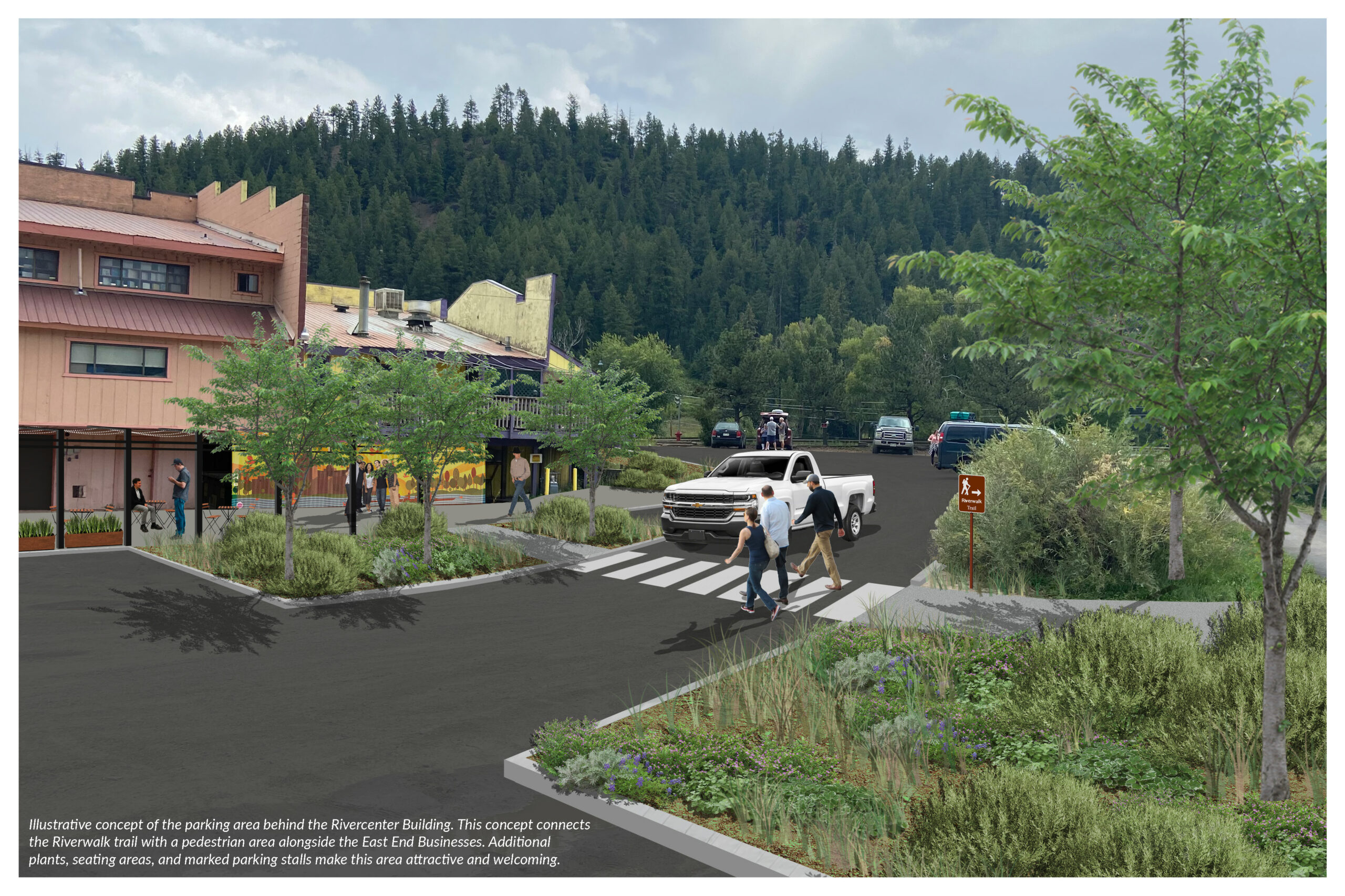
Illustrative Concept
"*" indicates required fields
Select Your Top Six Priority Projects
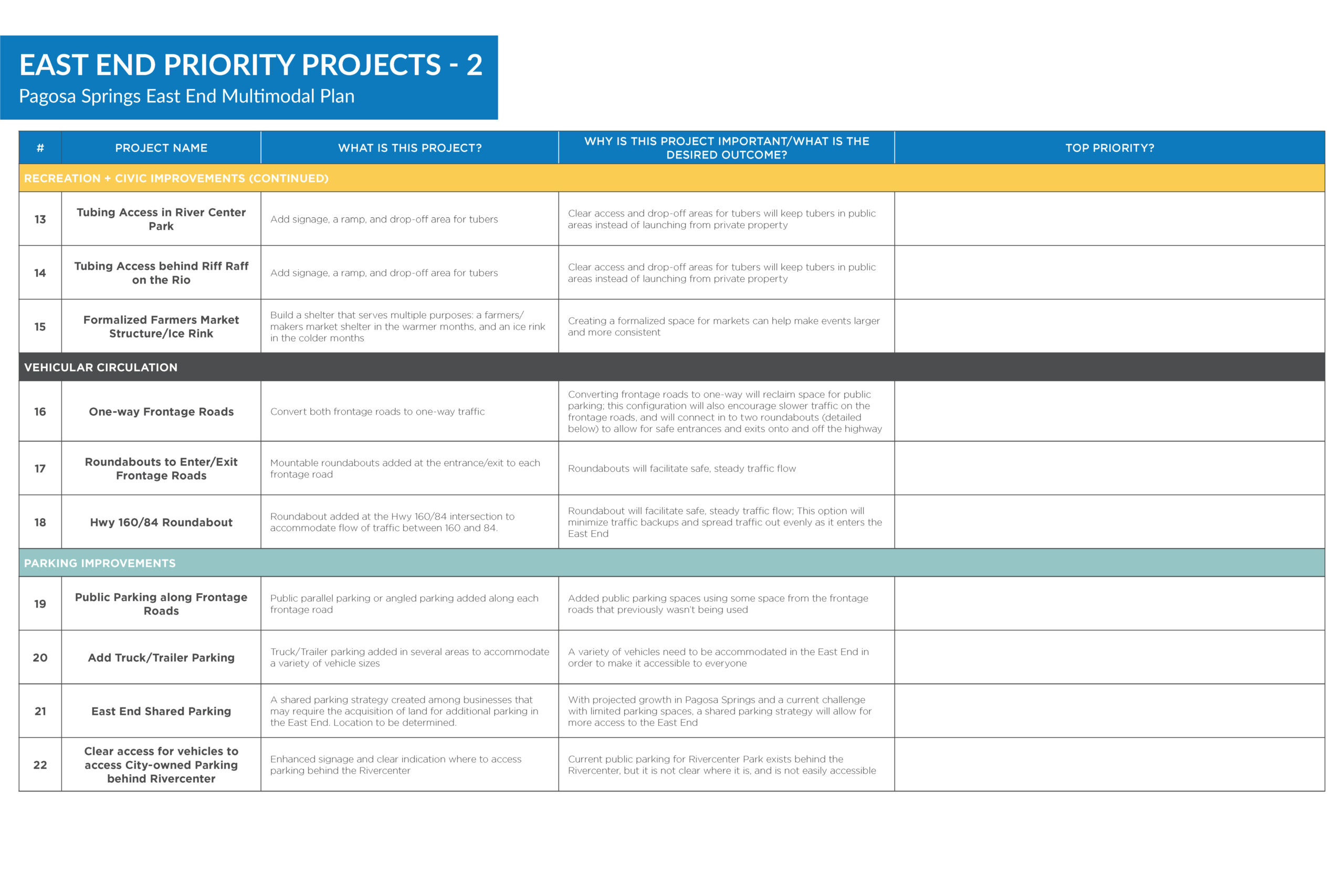
The following two tables list the 22 projects developed as part of this plan. The map shows where these projects would be located, based on the unique ID number associated with each project in the tables. We’re asking you to pick your top six priority projects to help determine which projects are most important to the public. To share your top six priority projects, select the unique project numbers in the dropdowns below.
East End Priority Projects – 1

Priority Project Overview
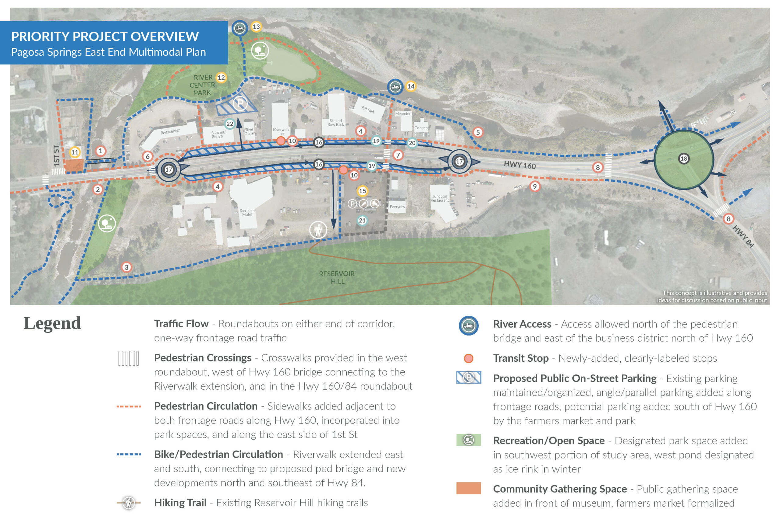
East End Priority Projects – 2
Timeline
The East End Multimodal Transportation Plan is scheduled to be completed by the fall of 2022.
Plan Events
Project KickoffEvents
Upcoming Events
Check back soon for upcoming events!
Past Events
East End Walking Tour
October 7, 2021
Public Meeting #2: Visioning
January 1, 2022
January – February 2022
Public Meeting #4: Recommendations & Priorities
September 21, 2022 at 5:00 pm – 7:00 pm
Project Documents
This section includes various project documents, exhibits, graphics, and other project development materials to be shared with you throughout the process. Keep checking back here to see our progress!
Public Meeting #4 Boards
Download pdf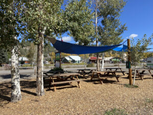
Public Meeting #3 Boards
Download pdf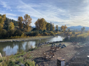
Public Open House Station Boards
Download pdf
Virtual Open House Summary
Download pdfContact
If you have any comments or questions about the project, you can reach James Dickhoff, Town of Pagosa Springs Planning Department Director, at jdickhoff@pagosasprings.co.gov or use the form below to send the project team your comments and questions.